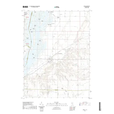
2021 Map of Lomax
USGS Topo · Published 2021About this map
Mississippi River islands and complex side-channels define the western edge of this Henderson County landscape, where the town of Lomax sits on the bluffs overlooking the bottomlands. The settlement pattern follows the high ground east of the river, with small communities like Carman, Iowa Junction, and Shokokon connected by a network of rural roads. The area is rich in family and local history, as evidenced by numerous burial sites including Crane Cem, Freeland Cem, and Gittings Mound Cem.
Find a feature on this map
63 named features on this map. Tap any name to fly to it.
Don’t see what you’re looking for? This feature index may not catch every label — zoom into the map to look around manually.
Map Details
Editions of this 2021 Lomax Map
This is the sole edition of this map. No revisions or reprints were ever made.
Other maps of this area

1918 · La Harpe
USGS Topo · 1:62,500

1932 · Lomax
USGS Topo · 1:62,500

1934 · Oquawka
USGS Topo · 1:48,000

1934 · Burlington
USGS Topo · 1:48,000

1937 · Lomax
USGS Topo · 1:62,500

1940 · Oquawka
USGS Topo · 1:62,500

1940 · Burlington
USGS Topo · 1:62,500

1958 · Burlington
USGS Topo · 1:250,000

1961 · Burlington
USGS Topo · 1:250,000

1963 · Burlington
USGS Topo · 1:250,000