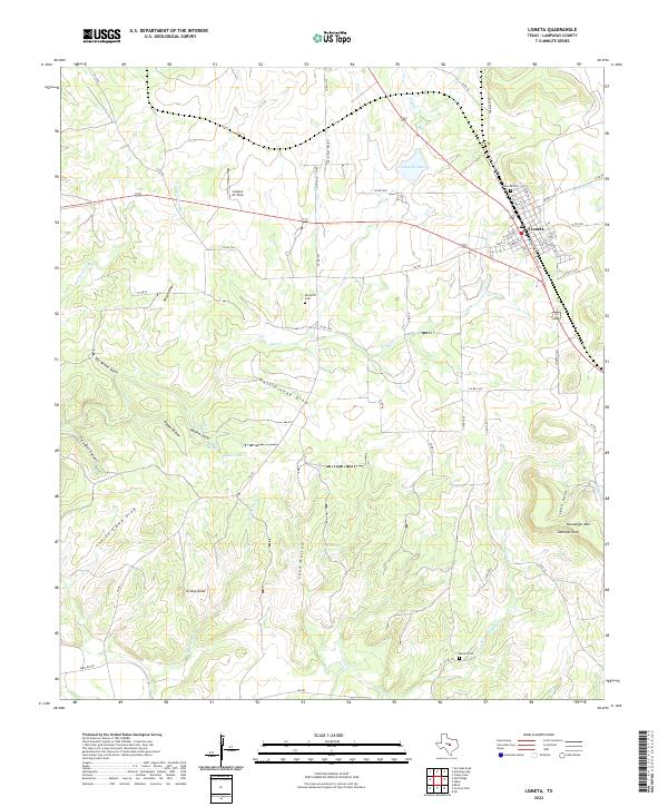
2022 Map of Lometa
USGS Topo · Published 2022About this map
Lometa serves as the primary hub of this Lampasas County landscape, situated at the junction of Highway 183 and 190. The town's grid is oriented along East Railway St, reflecting the transportation history of the region. Surrounding the town, the terrain is defined by a dense network of intermittent drainages and named draws, including Rattlesnake Draw and Indian Camp Draw. These watercourses carve through limestone uplands, leading to prominent elevations like Messanger Mtn and Grassy Knob.
Find a feature on this map
73 named features on this map. Tap any name to fly to it.
Don’t see what you’re looking for? This feature index may not catch every label — zoom into the map to look around manually.
Map Details
Editions of this 2022 Lometa Map
This is the sole edition of this map. No revisions or reprints were ever made.
Other maps of this area

1885 · San Saba
USGS Topo · 1:125,000

1887 · Lampasas
USGS Topo · 1:125,000

1894 · Lampasas
USGS Topo · 1:125,000

1894 · San Saba
USGS Topo · 1:125,000

1925 · San Saba 4-a
USGS Topo · 1:48,000

1925 · San Saba 1-d
USGS Topo · 1:48,000

1928 · Goldthwaite
USGS Topo · 1:62,500

1931 · Bend
USGS Topo · 1:62,500

1948 · Goldthwaite
USGS Topo · 1:62,500
1950 · Goldthwaite
USGS Topo · 1:62,500