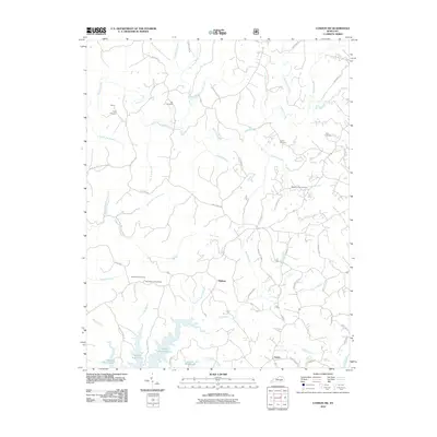
2010 Map of London SW
USGS Topo · Published 2010About this map
Laurel River Lake defines the southern edge of this Kentucky landscape, its winding shoreline and numerous inlets branching into the deep woods near the settlement of Keavy. The terrain is defined by a dense network of waterways, with Sinking Creek and Cane Creek carving through the hills toward the Laurel River. Higher elevations are marked by distinctive landmarks like Hightop and the Bald Rock Lookout Tower, which stands near the Bald Rock Picnic Area. Small family and community burial grounds, including the Nix Cemetery, Early Cemetery, and Floyd Cemetery, are scattered across the quadrangle, reflecting the area's rural heritage. This 2010 edition illustrates the modern road network, including White Oak Rd and Sinking Creek Rd, which follow the natural ridgelines and creek beds that have long dictated movement through this part of Laurel County.
Find a feature on this map
71 named features on this map. Tap any name to fly to it.
Don’t see what you’re looking for? This feature index may not catch every label — zoom into the map to look around manually.
Map Details
Editions of this 2010 London SW Map
This is the sole edition of this map. No revisions or reprints were ever made.
Other maps of this area

1890 · Williamsburg
USGS Topo · 1:125,000

1893 · London
USGS Topo · 1:125,000

1894 · Williamsburg
USGS Topo · 1:125,000

1897 · London
USGS Topo · 1:125,000

1952 · Corbin
USGS Topo · 1:24,000

1952 · Lily
USGS Topo · 1:24,000

1952 · London SW
USGS Topo · 1:24,000

1952 · Vox
USGS Topo · 1:24,000

1952 · Billows
USGS Topo · 1:24,000

1952 · Ano
USGS Topo · 1:24,000