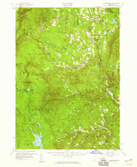
1957 Map of Londonderry
USGS Topo · Published 1959About this map
Hapgood State Forest and the Green Mountain National Forest dominate this mid-century topographic record of the Vermont uplands. The landscape is defined by the high ridges of Stratton Mountain and Glebe Mountain, with the Long Trail (Appalachian Trail) winding north toward Bromley Mountain. This era captures the early development of Vermont's winter recreation industry, evidenced by the Snow Valley Ski Area and Big Bromley Ski Area, alongside the older agricultural and timber patterns of the West River valley.
Find a feature on this map
98 named features on this map. Tap any name to fly to it.
Don’t see what you’re looking for? This feature index may not catch every label — zoom into the map to look around manually.
Map Details
Editions of this 1957 Londonderry Map
3 editions found
Other maps of this area

1889 · Wilmington
USGS Topo · 1:62,500

1891 · Wilmington
USGS Topo · 1:62,500

1891 · Brattleboro
USGS Topo · 1:62,500

1893 · Wallingford
USGS Topo · 1:62,500

1893 · Brattleboro
USGS Topo · 1:62,500

1894 · Londonderry
USGS Topo · 1:62,500

1894 · Pawlet
USGS Topo · 1:62,500

1894 · Equinox
USGS Topo · 1:62,500

1896 · Equinox
USGS Topo · 1:62,500

1897 · Pawlet
USGS Topo · 1:62,500