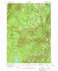
1957 Map of Londonderry
USGS Topo · Published 1967About this map
The Green Mountain National Forest dominates this mid-century landscape, a terrain of high peaks and isolated valley settlements before the arrival of modern interstate connectivity. The Long Trail and Appalachian Trail wind through the western high ground, passing Stratton Mountain and the Stratton Lookout Tower. In the valleys, established villages like Londonderry and South Londonderry follow the course of the West River, while smaller hamlets such as French Hollow and Podunk reflect the traditional upland settlement patterns of Vermont's southern interior.
Find a feature on this map
98 named features on this map. Tap any name to fly to it.
Don’t see what you’re looking for? This feature index may not catch every label — zoom into the map to look around manually.
Map Details
Editions of this 1957 Londonderry Map
3 editions found
Other maps of this area

1889 · Wilmington
USGS Topo · 1:62,500

1891 · Wilmington
USGS Topo · 1:62,500

1891 · Brattleboro
USGS Topo · 1:62,500

1893 · Wallingford
USGS Topo · 1:62,500

1893 · Brattleboro
USGS Topo · 1:62,500

1894 · Londonderry
USGS Topo · 1:62,500

1894 · Pawlet
USGS Topo · 1:62,500

1894 · Equinox
USGS Topo · 1:62,500

1896 · Equinox
USGS Topo · 1:62,500

1897 · Pawlet
USGS Topo · 1:62,500