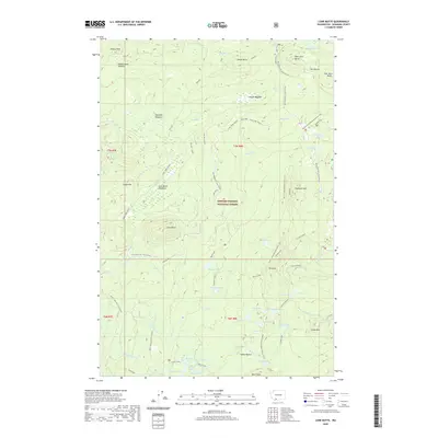
2020 Map of Lone Butte
USGS Topo · Published 2020About this map
Gifford Pinchot National Forest encompasses this high-elevation landscape in Skamania County, dominated by volcanic buttes and a dense network of glacial lakes and meadows. The area serves as a significant recreational and ecological corridor, centered on the Pacific Crest National Scenic Trail as it traverses the Indian Heaven wilderness. Distinctive landforms like Lone Butte and the Crazy Hills rise above numerous high-country water bodies, including Chenamus Lake, Placid Lake, and Lemei Lake. The presence of several winter-specific routes, such as the Lone Butte Sm Loop (Snow) and the Rush Creek Sno-Trail (Snow), highlights the seasonal utility of this terrain for forest access. From the heights of Sawtooth Mtn to the marshy stretches of Skookum Meadow, the map documents a geography defined by its volcanic peaks and subalpine hydrology.
Find a feature on this map
64 named features on this map. Tap any name to fly to it.
Don’t see what you’re looking for? This feature index may not catch every label — zoom into the map to look around manually.
Map Details
Editions of this 2020 Lone Butte Map
This is the sole edition of this map. No revisions or reprints were ever made.
Other maps of this area

1926 · Steamboat Mtn
USGS Topo · 1:125,000

1926 · Hood River
USGS Topo · 1:125,000

1929 · Hood River
USGS Topo · 1:125,000

1931 · Steamboat Mtn
USGS Topo · 1:125,000

1950 · Yakima
USGS Topo · 1:250,000

1953 · The Dalles
USGS Topo · 1:250,000

1956 · The Dalles
USGS Topo · 1:250,000

1957 · The Dalles
USGS Topo · 1:250,000

1957 · Wind River
USGS Topo · 1:62,500

1957 · Willard
USGS Topo · 1:62,500