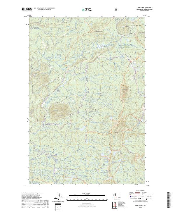
2023 Map of Lone Butte
USGS Topo · Published 2023About this map
The high volcanic plateau of the Indian Heaven Wilderness defines this portion of the Gifford Pinchot National Forest, where a dense concentration of subalpine lakes and meadows characterizes the landscape. The iconic Pacific Crest National Scenic Trl traverses the eastern half of the sheet, winding past prominent landmarks like Bird Mtn and Sawtooth Mtn. This area is a significant hydrological hub, with dozens of named water bodies including Chenamus Lake, Cultus Lake, and Wapiki Lake dotting the volcanic terrain.
Find a feature on this map
62 named features on this map. Tap any name to fly to it.
Don’t see what you’re looking for? This feature index may not catch every label — zoom into the map to look around manually.
Map Details
Editions of this 2023 Lone Butte Map
This is the sole edition of this map. No revisions or reprints were ever made.
Other maps of this area

1926 · Steamboat Mtn
USGS Topo · 1:125,000

1926 · Hood River
USGS Topo · 1:125,000

1929 · Hood River
USGS Topo · 1:125,000

1931 · Steamboat Mtn
USGS Topo · 1:125,000

1950 · Yakima
USGS Topo · 1:250,000

1953 · The Dalles
USGS Topo · 1:250,000

1956 · The Dalles
USGS Topo · 1:250,000

1957 · The Dalles
USGS Topo · 1:250,000

1957 · Wind River
USGS Topo · 1:62,500

1957 · Willard
USGS Topo · 1:62,500