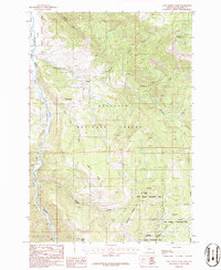
1986 Map of Lone Indian Peak
USGS Topo · Published 1986About this map
Gallatin State Wildlife Management Area and the high ridges of the Gallatin National Forest dominate this mid-1980s landscape in Montana. The terrain is defined by dramatic elevation changes, rising toward the summit of Lone Indian Peak and the high-altitude Golden Trout Lakes. A network of drainage systems, including Porcupine Creek and Elkhorn Creek, carves through the forest, while the Gallatin River runs along the western boundary. This survey documents a wilderness area largely shaped by conservation and resource management, where access is provided by a series of primitive Pack Trails. Local landmarks such as Lemondrop and Burnt Top stand as distinct topographical markers. The map captures the complex interaction of state and federal land management across Levinski Ridge, Elkhorn Ridge, and Blizzard Ridge.
Find a feature on this map
22 named features on this map. Tap any name to fly to it.
Don’t see what you’re looking for? This feature index may not catch every label — zoom into the map to look around manually.
Map Details
Editions of this 1986 Lone Indian Peak Map
2 editions found
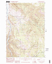
Other maps of this area

1888 · Three Forks
USGS Topo · 1:250,000

1894 · Three Forks
USGS Topo · 1:250,000

1895 · Three Forks
USGS Topo · 1:250,000

1947 · Bozeman
USGS Topo · 1:250,000

1948 · Bozeman
USGS Topo · 1:250,000

1950 · Spanish Peaks
USGS Topo · 1:62,500

1950 · Sphinx Mountain
USGS Topo · 1:62,500

1955 · Bozeman
USGS Topo · 1:250,000

1955 · Garnet Mountain
USGS Topo · 1:62,500

1955 · Crown Butte
USGS Topo · 1:62,500