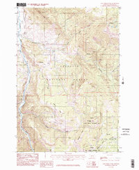
1986 Map of Lone Indian Peak
USGS Topo · Published 1986About this map
Lone Indian Peak stands as the central landmark in this high-altitude corner of the Gallatin National Forest, where a complex network of drainages flows toward the Gallatin River. The landscape is defined by massive geographic formations such as Levinski Ridge, Elkhorn Ridge, and Blizzard Ridge, illustrating the steep verticality of the Gallatin Range. To the northeast, the Golden Trout Lakes feed into various tributaries including North Fork Porcupine Creek and Fourth Creek. This 1986 provisional survey also documents the Gallatin State Wildlife Management Area, highlighting the intersection of federal forest lands and state-managed wildlife corridors. The concentration of named ridges and creek systems like Elkhorn Creek and Buffalo Horn Creek reveals a remote backcountry infrastructure of trails and seasonal crossings crucial for understanding the historical land use and wildlife patterns of the region.
Find a feature on this map
20 named features on this map. Tap any name to fly to it.
Don’t see what you’re looking for? This feature index may not catch every label — zoom into the map to look around manually.
Map Details
Editions of this 1986 Lone Indian Peak Map
2 editions found
Other maps of this area

1888 · Three Forks
USGS Topo · 1:250,000

1894 · Three Forks
USGS Topo · 1:250,000

1895 · Three Forks
USGS Topo · 1:250,000

1947 · Bozeman
USGS Topo · 1:250,000

1948 · Bozeman
USGS Topo · 1:250,000

1950 · Spanish Peaks
USGS Topo · 1:62,500

1950 · Sphinx Mountain
USGS Topo · 1:62,500

1955 · Bozeman
USGS Topo · 1:250,000

1955 · Garnet Mountain
USGS Topo · 1:62,500

1955 · Crown Butte
USGS Topo · 1:62,500