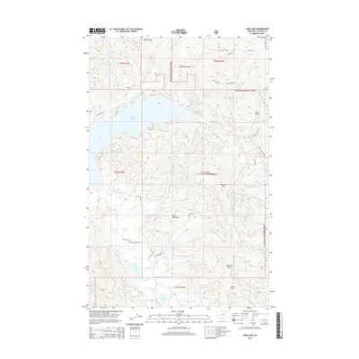
2014 Map of Lone Lake
USGS Topo · Published 2014About this map
Ashley Lake and its surrounding drainage basins dominate this part of the Flathead National Forest, where the elevations of the Salish Mountains reach their height at Boorman Peak. The landscape is defined by a dense network of seasonal drainages and named topographic depressions including McMannamy Draw, Rhodes Draw, and Dern Draw. These landforms dictate the passage of early transportation routes such as Oneil Creek Rd and Ashley Lake Rd.
Find a feature on this map
27 named features on this map. Tap any name to fly to it.
Don’t see what you’re looking for? This feature index may not catch every label — zoom into the map to look around manually.
Map Details
Editions of this 2014 Lone Lake Map
This is the sole edition of this map. No revisions or reprints were ever made.
Other maps of this area

1943 · Kalispell
USGS Topo · 1:125,000

1957 · Kalispell
USGS Topo · 1:250,000

1960 · Kalispell
USGS Topo · 1:250,000

1961 · Kalispell
USGS Topo · 1:250,000

1962 · Kila
USGS Topo · 1:24,000

1962 · Blue Grass Ridge
USGS Topo · 1:24,000

1962 · Lost Creek Divide
USGS Topo · 1:24,000

1962 · Ashley Mountain
USGS Topo · 1:24,000

1962 · Rhodes
USGS Topo · 1:24,000
1964 · Lone Lake
USGS Topo · 1:24,000