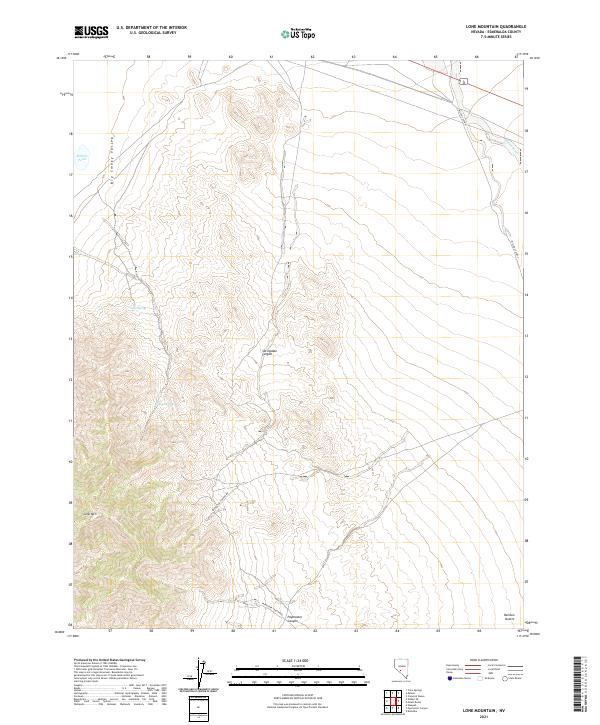
2021 Map of Lone Mountain
USGS Topo · Published 2021About this map
Lone Mtn stands as a dominant geological landmark in this part of Esmeralda County, overlooking the broad expanse of the Big Smoky Valley and the Ralston Desert. The map reveals a landscape defined by seasonal hydrology and desert corridors, with features like Springdale Canyon and Paymaster Canyon cutting through the terrain. These natural features serve as the backdrop for a network of remote desert routes, including Paymaster Canyon Rd and the distinctly named Miller's Cutoff.
Find a feature on this map
15 named features on this map. Tap any name to fly to it.
Don’t see what you’re looking for? This feature index may not catch every label — zoom into the map to look around manually.
Map Details
Editions of this 2021 Lone Mountain Map
This is the sole edition of this map. No revisions or reprints were ever made.
Other maps of this area

1898 · Silver Peak
USGS Topo · 1:125,000

1900 · Silver Peak
USGS Topo · 1:125,000

1907 · Tonopah
USGS Topo · 1:250,000

1908 · Lida
USGS Topo · 1:250,000

1908 · Tonopah
USGS Topo · 1:250,000

1913 · Lida
USGS Topo · 1:250,000

1945 · Goldfield
USGS Topo · 1:125,000

1954 · Goldfield
USGS Topo · 1:250,000

1955 · Goldfield
USGS Topo · 1:250,000

1956 · Tonopah
USGS Topo · 1:250,000