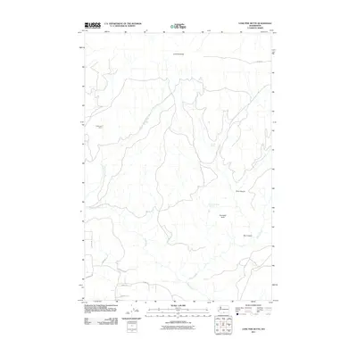
2011 Map of Lone Pine Butte
USGS Topo · Published 2011About this map
Holderman Camp sits along the western slopes of this Klickitat County landscape, an area defined by the drainage systems of Rock Creek and Quartz Creek. The terrain is marked by significant volcanic features, including Lone Pine Butte in the north and Tumwater Butte to the south. This 2011 survey by the U.S. Geological Survey illustrates a sparsely populated region where water sources were critical for land use, evidenced by the presence of Bear Spring, Stump Spring, and Tumwater Corral Spring. The road network consists primarily of rural and utility routes such as Bia 236 RD, Harbison Rd, and Ownby Rd, suggesting a mix of tribal land management and private ranching. Deep incisions in the landscape like Dairy Canyon and Box Canyon highlight the erosive force of the local waterways.
Find a feature on this map
17 named features on this map. Tap any name to fly to it.
Don’t see what you’re looking for? This feature index may not catch every label — zoom into the map to look around manually.
Map Details
Editions of this 2011 Lone Pine Butte Map
This is the sole edition of this map. No revisions or reprints were ever made.
Other maps of this area

1910 · Zillah
USGS Topo · 1:125,000

1916 · Arlington
USGS Topo · 1:125,000

1937 · White Swan
USGS Topo · 1:125,000

1950 · Yakima
USGS Topo · 1:250,000

1953 · The Dalles
USGS Topo · 1:250,000

1956 · The Dalles
USGS Topo · 1:250,000

1957 · The Dalles
USGS Topo · 1:250,000

1957 · Satus Pass
USGS Topo · 1:62,500

1958 · Yakima
USGS Topo · 1:250,000

1961 · Yakima
USGS Topo · 1:250,000