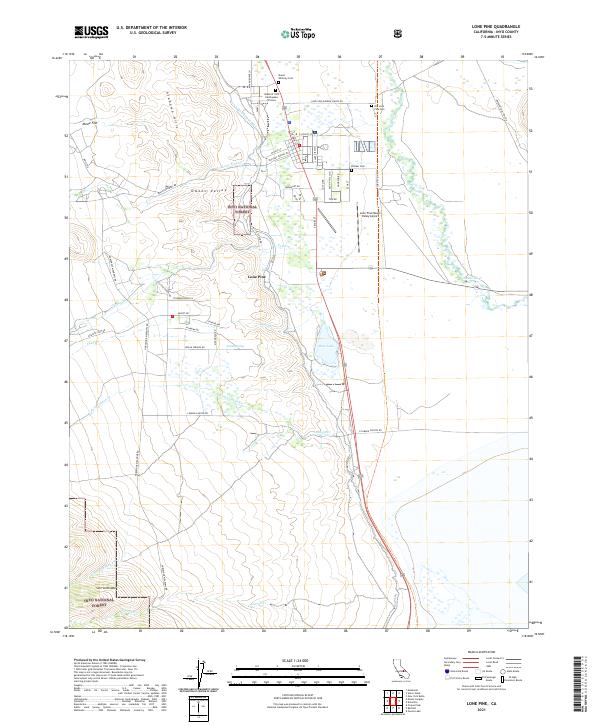
2021 Map of Lone Pine
USGS Topo · Published 2021About this map
The Grave of 1872 Earthquake Victims serves as a solemn landmark on the northern edge of Lone Pine, reflecting the seismic history of the Owens Valley. This survey captures the complex intersection of natural geology and human engineering, where the Los Angeles Aqueduct snakes across the terrain between the Alabama Hills and the Owens River. The map reveals a landscape defined by water rights and mountain runoff, with Lone Pine Cr and Tuttle Cr feeding into the valley floor. Genealogists will find several burial sites noted, including Mount Whitney Cem and the Old Lone Pine Cem. To the west, the transition into the Sierra Nevada begins at the edge of the Inyo National Forest, while Movie Flat indicates the region’s long-standing connection to the film industry.
Find a feature on this map
56 named features on this map. Tap any name to fly to it.
Don’t see what you’re looking for? This feature index may not catch every label — zoom into the map to look around manually.
Map Details
Editions of this 2021 Lone Pine Map
This is the sole edition of this map. No revisions or reprints were ever made.
Other maps of this area

1905 · Olancha
USGS Topo · 1:125,000

1907 · Olancha
USGS Topo · 1:125,000

1907 · Mt. Whitney
USGS Topo · 1:125,000

1908 · Ballarat
USGS Topo · 1:250,000

1913 · Ballarat
USGS Topo · 1:250,000

1919 · Mt. Whitney
USGS Topo · 1:125,000

1937 · Mt. Whitney
USGS Topo · 1:125,000

1948 · Death Valley
USGS Topo · 1:250,000

1948 · Fresno
USGS Topo · 1:250,000

1950 · New York Butte
USGS Topo · 1:62,500