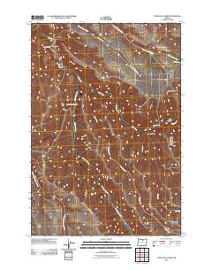
2011 Map of Lone Rock Creek
USGS Topo · Published 2011About this map
Rock Creek and its many tributaries, including the winding Lone Rock Creek, carve a complex drainage system through this high-plateau landscape of Gilliam County. Early 21st-century ranching life is centered on landmarks such as the Murtha Ranch in the northwestern corner, tucked near Bruce Hollow. The map reveals a topography defined by steep-walled canyons and ridges, where the Needle Fork and Lob Fork meet in the lower elevations. The road network is sparse, with Lonerock Rd and Hail Ridge Rd providing the primary access through the broken terrain. Significant elevation changes are marked by Pine Ridge to the southwest and numerous named draws like McPherson Canyon and Sweetmilk Canyon, which demonstrate the intricate natural irrigation and erosion patterns of the Oregon backcountry before they reach the East Fork Thirtymile Creek drainage.
Find a feature on this map
16 named features on this map. Tap any name to fly to it.
Don’t see what you’re looking for? This feature index may not catch every label — zoom into the map to look around manually.
Map Details
Editions of this 2011 Lone Rock Creek Map
This is the sole edition of this map. No revisions or reprints were ever made.
Other maps of this area

1916 · Condon
USGS Topo · 1:125,000

1953 · Pendleton
USGS Topo · 1:250,000

1953 · The Dalles
USGS Topo · 1:250,000

1956 · The Dalles
USGS Topo · 1:250,000

1956 · Pendleton
USGS Topo · 1:250,000

1957 · The Dalles
USGS Topo · 1:250,000

1968 · Gooseberry
USGS Topo · 1:24,000

1968 · Eightmile
USGS Topo · 1:24,000

1969 · Lefevre Prairie
USGS Topo · 1:24,000

1969 · Buttermilk Canyon
USGS Topo · 1:24,000