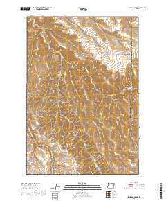
2020 Map of Lone Rock Creek
USGS Topo · Published 2020About this map
Lone Rock Creek and its complex network of tributaries, including Needle Fork and Lob Fork, carve through this high desert terrain on the boundary of Gilliam and Morrow counties. The landscape is defined by its deep drainage patterns, with significant features like McPherson Canyon and Lyons Canyon shaping the local topography. This region is marked by a network of ridge-top roads, such as Hale Ridge Rd and Lone Rock Rd, which follow the natural contours of the land to connect the various valleys. In the northwest, Bruce Hollow provides a distinct break in the elevation, while Pine Ridge stands as a prominent high point in the southwest corner. The drainage of E Fork Thirtymile Creek further illustrates the intricate watershed system that defines this part of the Oregon interior.
Find a feature on this map
23 named features on this map. Tap any name to fly to it.
Don’t see what you’re looking for? This feature index may not catch every label — zoom into the map to look around manually.
Map Details
Editions of this 2020 Lone Rock Creek Map
This is the sole edition of this map. No revisions or reprints were ever made.
Other maps of this area

1916 · Condon
USGS Topo · 1:125,000

1953 · Pendleton
USGS Topo · 1:250,000

1953 · The Dalles
USGS Topo · 1:250,000

1956 · The Dalles
USGS Topo · 1:250,000

1956 · Pendleton
USGS Topo · 1:250,000

1957 · The Dalles
USGS Topo · 1:250,000

1968 · Gooseberry
USGS Topo · 1:24,000

1968 · Eightmile
USGS Topo · 1:24,000

1969 · Lefevre Prairie
USGS Topo · 1:24,000

1969 · Buttermilk Canyon
USGS Topo · 1:24,000