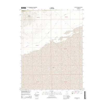
2014 Map of Lone Rock NW
USGS Topo · Published 2014About this map
The Carson Sink dominates the basin floor in this arid stretch of Nevada, marking a vast terminal drainage area where the desert sands meet the remnants of an ancient lake bed. To the northwest, the topography shifts abruptly as the West Humboldt Range rises from the valley floor, creating a stark contrast between the low-lying sink and the sharp mountain contours. This area, spanning the border of Pershing Co and Churchill Co, is characterized by its isolation and the functional utility of the remote infrastructure that crosses it. The presence of Pole Line Rd underscores the historical and modern importance of utility corridors in navigating the Basin and Range province. This survey illustrates the convergence of high-altitude mountain terrain with the distinctive alkali flats of one of Nevada's most significant hydrographic features.
Find a feature on this map
10 named features on this map. Tap any name to fly to it.
Don’t see what you’re looking for? This feature index may not catch every label — zoom into the map to look around manually.
Map Details
Editions of this 2014 Lone Rock NW Map
This is the sole edition of this map. No revisions or reprints were ever made.
Other maps of this area

1908 · Carson Sink
USGS Topo · 1:250,000

1910 · Carson Sink
USGS Topo · 1:250,000

1931 · Lovelock
USGS Topo · 1:250,000

1935 · Lovelock
USGS Topo · 1:250,000

1951 · Carson Sink
USGS Topo · 1:62,500

1955 · Lovelock
USGS Topo · 1:250,000

1956 · Toulon
USGS Topo · 1:62,500

1956 · Lovelock
USGS Topo · 1:62,500

1957 · Reno
USGS Topo · 1:250,000

1959 · Lovelock
USGS Topo · 1:250,000