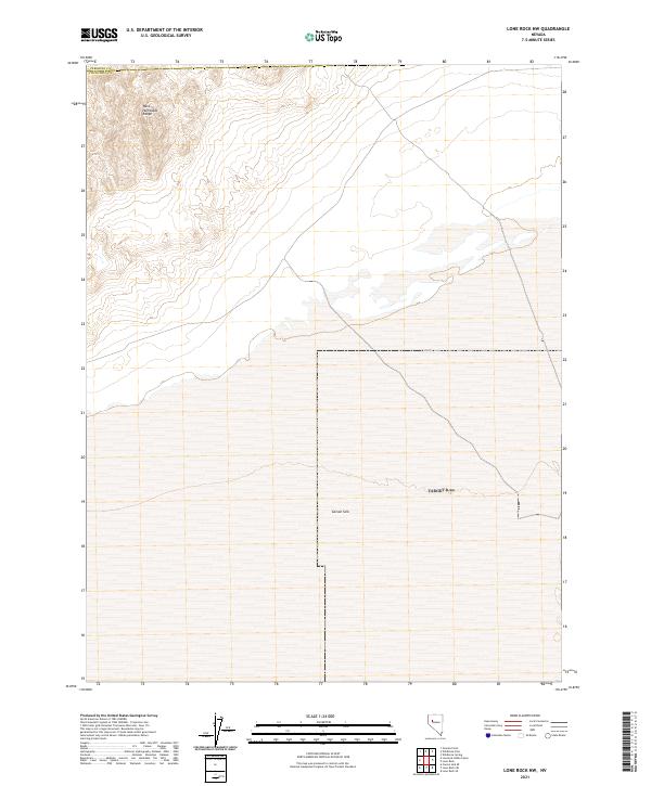
2021 Map of Lone Rock NW
USGS Topo · Published 2021About this map
Carson Sink dominates the southern reaches of this landscape, marking the terminus of the Carson River where it vanishes into the high desert basin. In the northern portion of the sheet, the steep contours of the West Humboldt Range rise sharply above the salt crust of the sink, providing a stark topographical contrast. This 2021 survey by the U.S. Geological Survey illustrates the transition between these rugged uplands and the expansive alkali flats of the Lahontan Basin. While modern infrastructure is sparse, the map clearly delineates the Pershing and Churchill county line as it cuts through the desolate salt flats and mountain foothills.
Find a feature on this map
9 named features on this map. Tap any name to fly to it.
Don’t see what you’re looking for? This feature index may not catch every label — zoom into the map to look around manually.
Map Details
Editions of this 2021 Lone Rock NW Map
This is the sole edition of this map. No revisions or reprints were ever made.
Other maps of this area

1908 · Carson Sink
USGS Topo · 1:250,000

1910 · Carson Sink
USGS Topo · 1:250,000

1931 · Lovelock
USGS Topo · 1:250,000

1935 · Lovelock
USGS Topo · 1:250,000

1951 · Carson Sink
USGS Topo · 1:62,500

1955 · Lovelock
USGS Topo · 1:250,000

1956 · Toulon
USGS Topo · 1:62,500

1956 · Lovelock
USGS Topo · 1:62,500

1957 · Reno
USGS Topo · 1:250,000

1959 · Lovelock
USGS Topo · 1:250,000