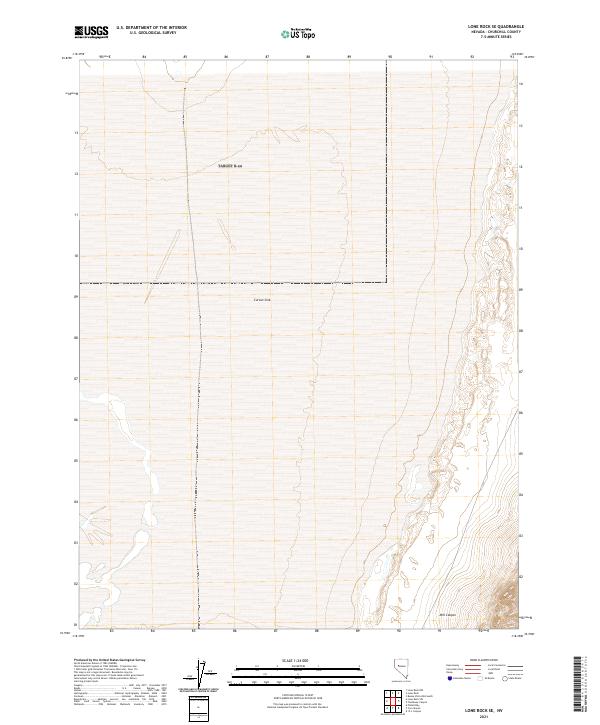
2021 Map of Lone Rock SE
USGS Topo · Published 2021About this map
Carson Sink dominates the topography of this portion of Churchill County, representing the terminus of the Carson River system. This 2021 topographic survey illustrates the stark, low-lying expanse of the terminal lake bed, where elevations shift subtly across the basin floor. The eastern edge of the quadrangle rises toward the foothills where Mill Canyon emerges as a distinct drainage feature. Surveyed using modern data from the National Hydrography Dataset and National Elevation Dataset, the map captures the hydraulic character of this arid interior drainage basin. The Public Land Survey System grid, including townships t23n r32e, t23n r33e, t22n r32e, and t22n r33e, provides the primary reference for land divisions across this uninhabited landscape.
Find a feature on this map
6 named features on this map. Tap any name to fly to it.
Don’t see what you’re looking for? This feature index may not catch every label — zoom into the map to look around manually.
Map Details
Editions of this 2021 Lone Rock SE Map
This is the sole edition of this map. No revisions or reprints were ever made.
Other maps of this area

1908 · Carson Sink
USGS Topo · 1:250,000

1910 · Carson Sink
USGS Topo · 1:250,000

1957 · Reno
USGS Topo · 1:250,000

1959 · Reno
USGS Topo · 1:250,000

1960 · Reno
USGS Topo · 1:250,000

1966 · Dixie Hot Springs
USGS Topo · 1:62,500
1969 · Lone Rock SW
USGS Topo · 1:24,000

1969 · Cox Canyon
USGS Topo · 1:24,000

1969 · Pintail Bay
USGS Topo · 1:24,000
1969 · Lone Rock
USGS Topo · 1:24,000