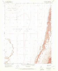
1969 Map of Lone Rock SE
USGS Topo · Published 1972About this map
The Carson Sink dominates this landscape in Churchill County, Nevada, represented here as an expansive Alkali Flat where water rarely lingers. This arid environment is defined by its isolation and specialized land use during the late 1960s, notably featuring a large Navy Bombing Target Area in the northwest quadrant. The topography is a stark arrangement of shifting Sand Dunes and minimal human infrastructure, consisting primarily of a solitary Jeep Trail cutting through the basin.
Find a feature on this map
8 named features on this map. Tap any name to fly to it.
Don’t see what you’re looking for? This feature index may not catch every label — zoom into the map to look around manually.
Map Details
Editions of this 1969 Lone Rock SE Map
This is the sole edition of this map. No revisions or reprints were ever made.
Other maps of this area

1908 · Carson Sink
USGS Topo · 1:250,000

1910 · Carson Sink
USGS Topo · 1:250,000

1957 · Reno
USGS Topo · 1:250,000

1959 · Reno
USGS Topo · 1:250,000

1960 · Reno
USGS Topo · 1:250,000

1966 · Dixie Hot Springs
USGS Topo · 1:62,500
1969 · Lone Rock SW
USGS Topo · 1:24,000

1969 · Cox Canyon
USGS Topo · 1:24,000

1969 · Pintail Bay
USGS Topo · 1:24,000
1969 · Lone Rock
USGS Topo · 1:24,000