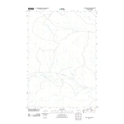
2011 Map of Lone Tree Creek
USGS Topo · Published 2011About this map
Lone Tree Creek and Cottonwood Creek dominate this corner of Carter County, Montana, carving a complex drainage network across the plains. The landscape is defined by the ephemeral flow of these waterways and the sparse infrastructure required for ranching and land management in the early 21st century. Named routes like Chimney Rock Rd and Sheep Mt Rd provide the primary access through this open country, tracing the natural contours of the land between the drainages. Far to the north, Hackberry Creek enters the frame, marking the divide between various grazing allotments. This survey illustrates the persistence of traditional land-use patterns, where a handful of maintained roads like Cottonwood Creek Rd serve as the vital arteries connecting isolated ranching outposts in the vast Montana rangeland.
Find a feature on this map
6 named features on this map. Tap any name to fly to it.
Don’t see what you’re looking for? This feature index may not catch every label — zoom into the map to look around manually.
Map Details
Editions of this 2011 Lone Tree Creek Map
This is the sole edition of this map. No revisions or reprints were ever made.
Other maps of this area

1954 · Ekalaka
USGS Topo · 1:250,000

1956 · Ekalaka
USGS Topo · 1:250,000

1958 · Ekalaka
USGS Topo · 1:250,000

1965 · Ekalaka
USGS Topo · 1:250,000

1980 · Prairie Dog Creek
USGS Topo · 1:24,000

1980 · Cactus Creek West
USGS Topo · 1:24,000

1980 · Finger Buttes East
USGS Topo · 1:24,000

1980 · Belltower Butte
USGS Topo · 1:24,000
1980 · School Section Creek
USGS Topo · 1:24,000
1980 · Capitol NW
USGS Topo · 1:24,000