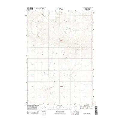
2014 Map of Lone Tree Creek
USGS Topo · Published 2014About this map
Lone Tree Creek and Cottonwood Creek weave through this section of Carter County, defining the drainage patterns of a landscape marked by significant elevation changes. The presence of Sheep Mountain Rd and Chimney Rock Rd provides the primary infrastructure for this ranching and grazing territory. In the northern reaches, Hackberry Creek flows through the drainages of t4s r60e, showing the rugged topography typical of southeastern Montana. The map illustrates the Public Land Survey System grid across t5s r60e, where the interplay of seasonal watercourses and upland ridges shaped the historical boundary lines and early access routes of the region.
Find a feature on this map
7 named features on this map. Tap any name to fly to it.
Don’t see what you’re looking for? This feature index may not catch every label — zoom into the map to look around manually.
Map Details
Editions of this 2014 Lone Tree Creek Map
This is the sole edition of this map. No revisions or reprints were ever made.
Other maps of this area

1954 · Ekalaka
USGS Topo · 1:250,000

1956 · Ekalaka
USGS Topo · 1:250,000

1958 · Ekalaka
USGS Topo · 1:250,000

1965 · Ekalaka
USGS Topo · 1:250,000

1980 · Prairie Dog Creek
USGS Topo · 1:24,000

1980 · Cactus Creek West
USGS Topo · 1:24,000

1980 · Finger Buttes East
USGS Topo · 1:24,000

1980 · Belltower Butte
USGS Topo · 1:24,000
1980 · School Section Creek
USGS Topo · 1:24,000
1980 · Capitol NW
USGS Topo · 1:24,000