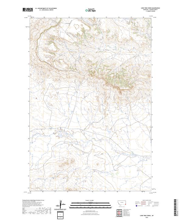
2024 Map of Lone Tree Creek
USGS Topo · Published 2024About this map
Lone Tree Creek flows through the southern reaches of this Carter County landscape, marking a drainage system that includes Cottonwood Creek and Hackberry Creek. The terrain is defined by the high ground surrounding Sheep Mountain Rd and Sheep Mt Rd in the north, where the drainage patterns of the northern breaks are clearly visible. This 2024 USGS survey provides precise details on the modern road network, including Chimney Rock Rd, which traverses the high ridges. The map illustrates the characteristic section-line organization of eastern Montana, with townships such as t4s r60e and t5s r60e established across the open plains and breaks. This is a contemporary record of a sparsely populated ranching landscape where watercourses and primitive roads remain the primary landmarks for navigating the vast northern plains.
Find a feature on this map
10 named features on this map. Tap any name to fly to it.
Don’t see what you’re looking for? This feature index may not catch every label — zoom into the map to look around manually.
Map Details
Editions of this 2024 Lone Tree Creek Map
This is the sole edition of this map. No revisions or reprints were ever made.
Other maps of this area

1954 · Ekalaka
USGS Topo · 1:250,000

1956 · Ekalaka
USGS Topo · 1:250,000

1958 · Ekalaka
USGS Topo · 1:250,000

1965 · Ekalaka
USGS Topo · 1:250,000

1980 · Prairie Dog Creek
USGS Topo · 1:24,000

1980 · Cactus Creek West
USGS Topo · 1:24,000

1980 · Finger Buttes East
USGS Topo · 1:24,000

1980 · Belltower Butte
USGS Topo · 1:24,000
1980 · School Section Creek
USGS Topo · 1:24,000
1980 · Capitol NW
USGS Topo · 1:24,000