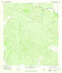
1971 Map of Lone Tree Hill
USGS Topo · Published 1974About this map
The Frio River and the Leona River anchor this South Texas landscape along the border of Uvalde and Zavala counties. In the early 1970s, this area remained largely defined by its drainage systems and subtle topography, notably Lone Tree Hill which stands as a prominent local landmark. The terrain is crisscrossed by several seasonal waterways, including Liveoak Creek and Elm Creek, which dictate the rural movement across the ranching country.
Find a feature on this map
11 named features on this map. Tap any name to fly to it.
Don’t see what you’re looking for? This feature index may not catch every label — zoom into the map to look around manually.
Map Details
Editions of this 1971 Lone Tree Hill Map
This is the sole edition of this map. No revisions or reprints were ever made.
Other maps of this area

1898 · Uvalde
USGS Topo · 1:125,000

1899 · Uvalde
USGS Topo · 1:125,000

1928 · Frio Town
USGS Topo · 1:62,500

1942 · Divot
USGS Topo · 1:62,500

1953 · Crystal City
USGS Topo · 1:250,000

1954 · San Antonio
USGS Topo · 1:250,000

1955 · Crystal City
USGS Topo · 1:250,000

1956 · Divot
USGS Topo · 1:62,500

1957 · San Antonio
USGS Topo · 1:250,000

1957 · Batesville
USGS Topo · 1:62,500