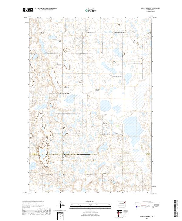
2021 Map of Lone Tree Lake
USGS Topo · Published 2021About this map
The Coteau des Prairies plateau dominates this section of South Dakota, where the highland terrain is pocketed with numerous glacial depressions and wetlands. This landscape spans the border of Day Co and Clark Co, defined by a network of sectional roads like Co Rd 35 and 150th St that navigate around the region's many unnamed water bodies. Near the southern edge of the survey, the namesake Lone Tree Lake is situated amongst the undulating prairie topography. To the north, Mud Creek winds through the western sections, while the Saint Ansgaar Cem serves as a small but significant historical marker of early settlement and community heritage in this rural prairie environment.
Find a feature on this map
29 named features on this map. Tap any name to fly to it.
Don’t see what you’re looking for? This feature index may not catch every label — zoom into the map to look around manually.
Map Details
Editions of this 2021 Lone Tree Lake Map
This is the sole edition of this map. No revisions or reprints were ever made.
Other maps of this area

1953 · Milbank
USGS Topo · 1:250,000

1958 · Milbank
USGS Topo · 1:250,000

1958 · Andover SW
USGS Topo · 1:24,000
1958 · Crandall
USGS Topo · 1:24,000
1973 · Crocker SW
USGS Topo · 1:24,000

1973 · Lily
USGS Topo · 1:24,000

1973 · Bristol West
USGS Topo · 1:24,000

1973 · Bradley
USGS Topo · 1:24,000

1973 · Lone Tree Lake
USGS Topo · 1:24,000

1973 · Bristol East
USGS Topo · 1:24,000