
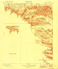
1916 Map of Lone Tree Valley
USGS Topo · Published 1916About this map
Los Medanos and the intricate canyon systems of eastern Contra Costa County define this 1913 survey, published just before the United States entered the Great War. The landscape is primarily shaped by a series of parallel valleys including Horse Valley, Deer Valley, and Briones Valley, which drain toward the northeast. Early industrial activity is evident in Markley Canyon where clusterings of Oil Tanks are recorded near the hills, while the agricultural and ranching character of the region is anchored by local institutions like Deer Valley School and Marsh Creek School. In the north, the Southern Pacific railroad passes through the small settlement of Newlove, providing a vital transportation link for this inland area. The map also clearly delineates the Mt Diablo Base Line, a critical surveying marker for California land titles.
Find a feature on this map
17 named features on this map. Tap any name to fly to it.
Don’t see what you’re looking for? This feature index may not catch every label — zoom into the map to look around manually.
Map Details
Editions of this 1916 Lone Tree Valley Map
2 editions found
Other maps of this area

1896 · Mt. Diablo
USGS Topo · 1:62,500

1898 · Mt. Diablo
USGS Topo · 1:62,500

1907 · Antioch
USGS Topo · 1:62,500

1908 · Antioch
USGS Topo · 1:62,500

1910 · Jersey
USGS Topo · 1:31,680

1911 · Byron Hot Springs
USGS Topo · 1:31,680

1914 · Brentwood
USGS Topo · 1:31,680

1916 · Byron Hot Springs
USGS Topo · 1:31,680

1916 · Byron
USGS Topo · 1:62,500

1918 · Honker Bay
USGS Topo · 1:31,680