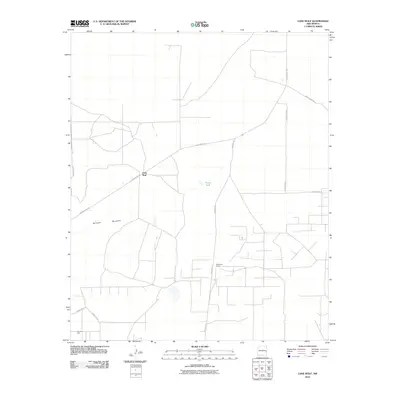
2010 Map of Lone Wolf
USGS Topo · Published 2010About this map
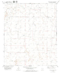
Railroad Mountain rises from the high plains of Chaves County, anchoring a landscape defined by ranching and energy extraction during the early twenty-first century. This survey documents the network of ranch roads and oil infrastructure that crisscrosses the arid terrain, notably around the Lone Wolf settlement. To the southeast, McCombs Ranch sits amidst a web of local routes like Hanover Rd, while the southern reaches of the quadrangle are marked by the industrial presence of the Cato Oil Field. The sparse distribution of water, represented by features such as North Tank, highlights the importance of managed resources in this part of New Mexico. Local connectivity is maintained through a system of numbered county roads and named paths such as Railroad Mt Rd and Moon Ranch Rd, which link isolated homesteads and drilling sites.
Find a feature on this map
13 named features on this map. Tap any name to fly to it.
Don’t see what you’re looking for? This feature index may not catch every label — zoom into the map to look around manually.
Map Details
Editions of this 2010 Lone Wolf Map
This is the sole edition of this map. No revisions or reprints were ever made.
Other maps of this area

1954 · Brownfield
USGS Topo · 1:250,000

1958 · Brownfield
USGS Topo · 1:250,000

1962 · Brownfield
USGS Topo · 1:250,000

1978 · Curlew Lake
USGS Topo · 1:24,000
1978 · Presler Lake
USGS Topo · 1:24,000

1978 · Button Mesa North
USGS Topo · 1:24,000

1979 · Kenna
USGS Topo · 1:24,000
1979 · Kenna SW
USGS Topo · 1:24,000
1979 · Schram Lake
USGS Topo · 1:24,000
1979 · Curlew Lake SE
USGS Topo · 1:24,000