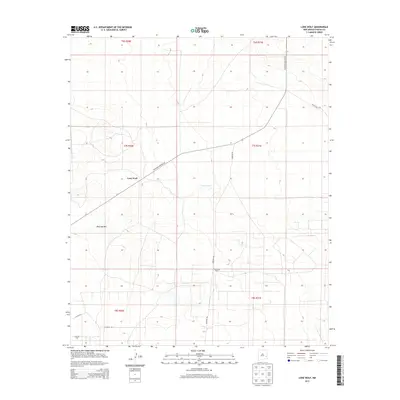
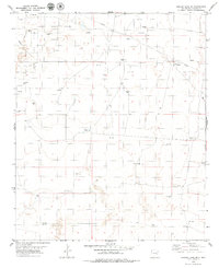
2013 Map of Lone Wolf
USGS Topo · Published 2013About this map
Lone Wolf serves as the focal point of this Chaves County landscape, situated where the high plains meet distinct geological elevations. The settlement is positioned near the prominent rise of Railroad Mtn, a terrain feature that likely influenced early transportation routes through this part of New Mexico. The map illustrates a shift from traditional ranching landmarks to industrial usage, characterized by the Cato Oil Field in the southwest and a network of arterial roads including Railroad Mountr Rd and Hanover Rd. The presence of North Tank indicates the vital role of managed water sources in this arid environment, while the grid of township and range lines, such as t7s r31e, defines the systematic division of the land for mineral and agricultural interests.
Find a feature on this map
15 named features on this map. Tap any name to fly to it.
Don’t see what you’re looking for? This feature index may not catch every label — zoom into the map to look around manually.
Map Details
Editions of this 2013 Lone Wolf Map
This is the sole edition of this map. No revisions or reprints were ever made.
Other maps of this area

1954 · Brownfield
USGS Topo · 1:250,000

1958 · Brownfield
USGS Topo · 1:250,000

1962 · Brownfield
USGS Topo · 1:250,000

1978 · Curlew Lake
USGS Topo · 1:24,000
1978 · Presler Lake
USGS Topo · 1:24,000

1978 · Button Mesa North
USGS Topo · 1:24,000

1979 · Kenna
USGS Topo · 1:24,000
1979 · Kenna SW
USGS Topo · 1:24,000
1979 · Schram Lake
USGS Topo · 1:24,000
1979 · Curlew Lake SE
USGS Topo · 1:24,000