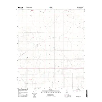
2017 Map of Lone Wolf
USGS Topo · Published 2017About this map
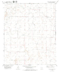
Lone Wolf anchors this high-desert landscape in Chaves County, situated at a crossroad of county routes and regional history. The terrain is defined by the prominent Railroad Mtn to the southwest, a natural landmark that gives its name to Railroad Mountain Rd, which cuts diagonally across the quadrangle. This area of New Mexico exemplifies the vast, surveyed expanses of the Public Land Survey System, with township and range lines like t7s r31e and t7s r30e neatly dividing the arid ground. Sparse water resources are noted by features such as N-Tank, illustrating the vital infrastructure required for ranching in this environment. The map provides a precise layout of the rural road network, including Co Rd 39 and Co Rd 34, which connect the isolated settlement of Lone Wolf to the surrounding plains.
Find a feature on this map
13 named features on this map. Tap any name to fly to it.
Don’t see what you’re looking for? This feature index may not catch every label — zoom into the map to look around manually.
Map Details
Editions of this 2017 Lone Wolf Map
This is the sole edition of this map. No revisions or reprints were ever made.
Other maps of this area

1954 · Brownfield
USGS Topo · 1:250,000

1958 · Brownfield
USGS Topo · 1:250,000

1962 · Brownfield
USGS Topo · 1:250,000

1978 · Curlew Lake
USGS Topo · 1:24,000
1978 · Presler Lake
USGS Topo · 1:24,000

1978 · Button Mesa North
USGS Topo · 1:24,000

1979 · Kenna
USGS Topo · 1:24,000
1979 · Kenna SW
USGS Topo · 1:24,000
1979 · Schram Lake
USGS Topo · 1:24,000
1979 · Curlew Lake SE
USGS Topo · 1:24,000