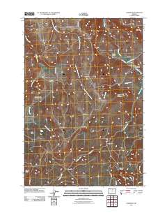
2011 Map of Lonerock
USGS Topo · Published 2011About this map
Lonerock anchors the northeastern corner of this Gilliam County landscape, where the town site sits at the confluence of Lone Rock Creek and Robinette Creek. The topography is defined by deeply incised drainages and high plateaus, including Oxhead Ridge and Lost Valley. The area’s ranching and agricultural history is reflected in the network of rural routes such as Lost Valley Rd and Lonerock Rd, which navigate the steep descent into various canyons. Small-scale industrial and community footprints appear in the southern half of the quadrangle, notably the Cone Mill site near Buckhorn Creek and the Lost Valley Cemetery located on a rise overlooking Lost Valley Creek. Natural water sources like Big Spring remain critical landmarks in this arid environment, punctuating a terrain marked by prominent geographic features like Stahl Canyon and Boone Canyon.
Find a feature on this map
25 named features on this map. Tap any name to fly to it.
Don’t see what you’re looking for? This feature index may not catch every label — zoom into the map to look around manually.
Map Details
Editions of this 2011 Lonerock Map
This is the sole edition of this map. No revisions or reprints were ever made.
Other maps of this area

1916 · Condon
USGS Topo · 1:125,000

1926 · Mitchell
USGS Topo · 1:125,000

1953 · Spray
USGS Topo · 1:62,500

1953 · Pendleton
USGS Topo · 1:250,000

1953 · The Dalles
USGS Topo · 1:250,000

1955 · Bend
USGS Topo · 1:250,000

1955 · Canyon City
USGS Topo · 1:250,000

1956 · The Dalles
USGS Topo · 1:250,000

1956 · Pendleton
USGS Topo · 1:250,000

1957 · Bend
USGS Topo · 1:250,000