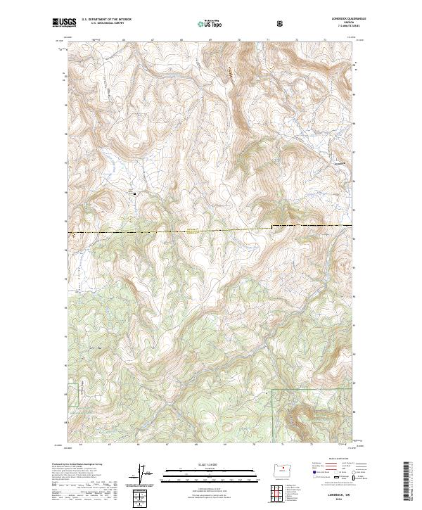
2024 Map of Lonerock
USGS Topo · Published 2024About this map
The settlement of Lonerock sits at the northern edge of this high-plateau landscape, where the deeply carved drainages of Lone Rock Creek and Buttermilk Canyon converge. This 2024 survey documents the rugged transition from the Umatilla National Forest in the south toward the Gilliam and Wheeler county line. The terrain is defined by prominent topographical features like Pine Ridge and Oxhead Ridge, which separate the various forks of the local creek systems. Genealogists and local historians will find the Lost Valley Cem along Lost Valley Rd, a small footprint of early homesteading history in this remote section of Oregon. The map illustrates a network of forest roads and trails, such as the Nat For Dev Rd 060 and Fire Ln, tracing the movement of people and livestock through steep canyons and along high ridges like Oxhead Ridge.
Find a feature on this map
26 named features on this map. Tap any name to fly to it.
Don’t see what you’re looking for? This feature index may not catch every label — zoom into the map to look around manually.
Map Details
Editions of this 2024 Lonerock Map
This is the sole edition of this map. No revisions or reprints were ever made.
Other maps of this area

1916 · Condon
USGS Topo · 1:125,000

1926 · Mitchell
USGS Topo · 1:125,000

1953 · Spray
USGS Topo · 1:62,500

1953 · Pendleton
USGS Topo · 1:250,000

1953 · The Dalles
USGS Topo · 1:250,000

1955 · Bend
USGS Topo · 1:250,000

1955 · Canyon City
USGS Topo · 1:250,000

1956 · The Dalles
USGS Topo · 1:250,000

1956 · Pendleton
USGS Topo · 1:250,000

1957 · Bend
USGS Topo · 1:250,000