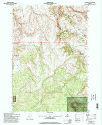
1995 Map of Lonerock
USGS Topo · Published 1998About this map
Lonerock serves as the central settlement on this mid-1990s survey, tucked into the high desert landscape where the boundaries of Gilliam Co and Wheeler Co meet. The area is defined by a complex network of canyons and ridges, including Boone Canyon and Stahl Canyon, which channel seasonal water toward Lone Rock Creek. To the south, the landscape rises into the Umatilla National Forest, marked by the distinct prominence of Cone Mt and the drainage of Buckhorn Creek.
Find a feature on this map
20 named features on this map. Tap any name to fly to it.
Don’t see what you’re looking for? This feature index may not catch every label — zoom into the map to look around manually.
Map Details
Editions of this 1995 Lonerock Map
This is the sole edition of this map. No revisions or reprints were ever made.
Other maps of this area

1916 · Condon
USGS Topo · 1:125,000

1926 · Mitchell
USGS Topo · 1:125,000

1953 · Spray
USGS Topo · 1:62,500

1953 · Pendleton
USGS Topo · 1:250,000

1953 · The Dalles
USGS Topo · 1:250,000

1955 · Bend
USGS Topo · 1:250,000

1955 · Canyon City
USGS Topo · 1:250,000

1956 · The Dalles
USGS Topo · 1:250,000

1956 · Pendleton
USGS Topo · 1:250,000

1957 · Bend
USGS Topo · 1:250,000