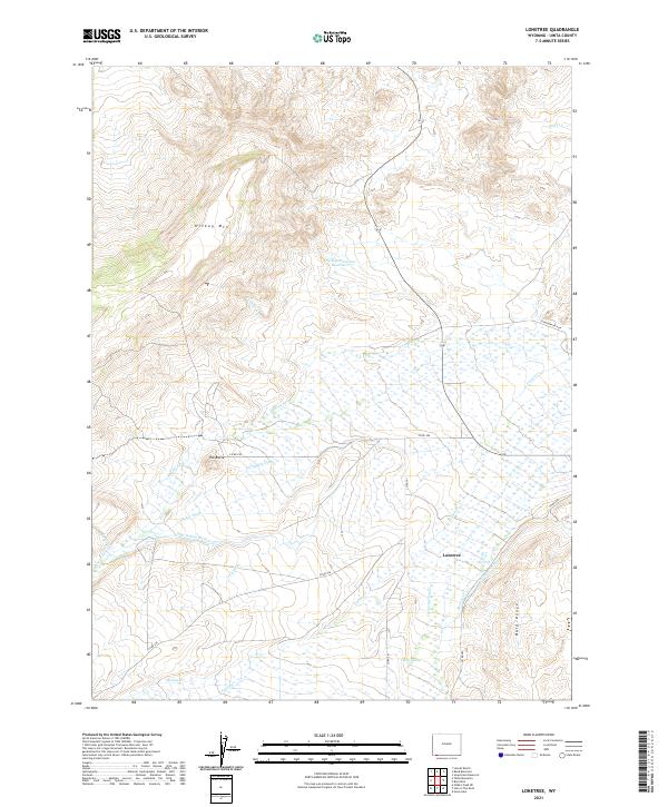
2021 Map of Lonetree
USGS Topo · Published 2021About this map
The settlement of Lonetree serves as the focal point for this high-elevation ranching and irrigation landscape in southwestern Wyoming. The area is defined by a sophisticated network of early water management features, including the Grimsley Ditch, Luckey Ditch, and Stag Hollow Ditch, which divert water from the Henrys Fork to support local agricultural operations. These man-made watercourses contrast with natural features like the winding Poison Cr and Lonetree Cr, illustrating the intensive modification of the high desert to sustain livestock and crops. High points such as Hickey Mtn and the Bald Range provide a dramatic backdrop to the drainage basins below, where the Hickey Mountain Reservoir manages seasonal runoff. This survey captures a region where survival is tied directly to the control of water, reflected in the density of named canals and ditches across the basin floor.
Find a feature on this map
29 named features on this map. Tap any name to fly to it.
Don’t see what you’re looking for? This feature index may not catch every label — zoom into the map to look around manually.
Map Details
Editions of this 2021 Lonetree Map
This is the sole edition of this map. No revisions or reprints were ever made.
Other maps of this area

1885 · Uinta
USGS Topo · 1:250,000

1905 · Gilbert Peak
USGS Topo · 1:125,000

1906 · Gilbert Peak
USGS Topo · 1:125,000

1954 · Salt Lake City
USGS Topo · 1:250,000

1954 · Ogden
USGS Topo · 1:250,000

1958 · Ogden
USGS Topo · 1:250,000

1958 · Salt Lake City
USGS Topo · 1:250,000

1960 · Ogden
USGS Topo · 1:250,000

1960 · Salt Lake City
USGS Topo · 1:250,000

1964 · Soap Holes Reservoir
USGS Topo · 1:24,000