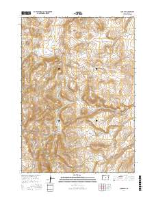
2017 Map of Long Barn
USGS Topo · Published 2017About this map
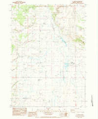
Hampton Buttes rise above the high desert floor in this 2017 study of Crook County, characterizing the interior drainage and isolated geography of central Oregon. The small settlement of Long Barn is situated in the southwestern portion of the sheet, serving as a localized point of activity within a network of land management sections. Water resources are defined by the intermittent flow of Clover Cr and the presence of Stone House Reservoir, features essential to the high-country landscape. Detailed topography reveals the winding paths of Sears Canyon and New Canyon, while the Price-Twelvemile Rd provides a primary transit corridor through the townships. This survey reflects the modern configuration of range land and public boundaries that define this remote region.
Find a feature on this map
13 named features on this map. Tap any name to fly to it.
Don’t see what you’re looking for? This feature index may not catch every label — zoom into the map to look around manually.
Map Details
Editions of this 2017 Long Barn Map
This is the sole edition of this map. No revisions or reprints were ever made.
Other maps of this area

1955 · Crescent
USGS Topo · 1:250,000

1957 · Crescent
USGS Topo · 1:250,000

1958 · Crescent
USGS Topo · 1:250,000

1970 · Crescent
USGS Topo · 1:250,000

1983 · Hampton Butte
USGS Topo · 1:24,000
1983 · Gerry Mtn
USGS Topo · 1:24,000

1983 · West of Hampton
USGS Topo · 1:24,000
1983 · Sand Hollow
USGS Topo · 1:24,000
1983 · Hampton
USGS Topo · 1:24,000
1983 · G.I. Ranch
USGS Topo · 1:24,000