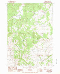
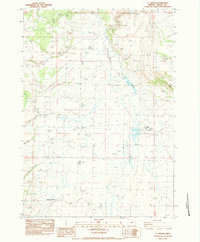
1983 Map of Long Barn
USGS Topo · Published 1983About this map
Gerry Mountain and the Hampton Buttes dominate this high-desert landscape in Crook County, revealing a network of springs and reservoirs critical for ranching and survival in the early 1980s. The map identifies specific infrastructure like the Stone House Reservoir and Garske Well, reflecting the importance of water management across the arid terrain. Names like Rhoda Cabin and Long Barn point to early homesteading and livestock history, while features like Alkali Flat and Meadow Gulch illustrate the varied drainage patterns and geologic composition of the region. A Single Wooden Pole Power Line cuts across the northern ridges, tracing the reach of mid-century utility expansion into these more isolated areas of Central Oregon. For those studying land use, the placement of Price Spring, Fossil Spring, and Culbertson Spring provides essential data on natural water sources around the buttes.
Find a feature on this map
37 named features on this map. Tap any name to fly to it.
Don’t see what you’re looking for? This feature index may not catch every label — zoom into the map to look around manually.
Map Details
Editions of this 1983 Long Barn Map
This is the sole edition of this map. No revisions or reprints were ever made.
Other maps of this area

1955 · Crescent
USGS Topo · 1:250,000

1957 · Crescent
USGS Topo · 1:250,000

1958 · Crescent
USGS Topo · 1:250,000

1970 · Crescent
USGS Topo · 1:250,000

1983 · Hampton Butte
USGS Topo · 1:24,000
1983 · Gerry Mtn
USGS Topo · 1:24,000

1983 · West of Hampton
USGS Topo · 1:24,000
1983 · Sand Hollow
USGS Topo · 1:24,000
1983 · Hampton
USGS Topo · 1:24,000
1983 · G.I. Ranch
USGS Topo · 1:24,000