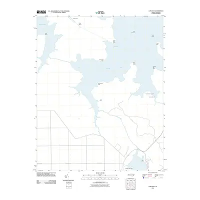
2010 Map of Long Bay
USGS Topo · Published 2010About this map
Long Bay and its complex network of interconnected sounds and points define this coastal landscape in Carteret County. The map details a transition from the open waters of Turnagain Bay and West Bay to more secluded reaches like Salters Creek. This area is characterized by low-lying maritime terrain, where named features such as Corn Sage Point, Swimming Point, and Hog Point break the shoreline. Navigation is central to this environment, marked by the presence of the Cedar Island Light, the Thorofare West Light, and the Thorofare West Day Beacon.
Find a feature on this map
21 named features on this map. Tap any name to fly to it.
Don’t see what you’re looking for? This feature index may not catch every label — zoom into the map to look around manually.
Map Details
Editions of this 2010 Long Bay Map
This is the sole edition of this map. No revisions or reprints were ever made.
Other maps of this area

1948 · North Bay
USGS Topo · 1:24,000

1949 · Atlantic
USGS Topo · 1:24,000

1949 · Styron Bay
USGS Topo · 1:24,000

1949 · Point Of Marsh
USGS Topo · 1:24,000

1949 · Long Bay
USGS Topo · 1:24,000

1949 · Williston
USGS Topo · 1:24,000

1949 · South River
USGS Topo · 1:24,000

1949 · Davis
USGS Topo · 1:24,000

1950 · Long Bay
USGS Topo · 1:24,000

1950 · South River
USGS Topo · 1:24,000