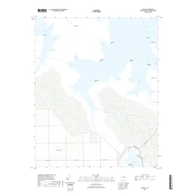
2019 Map of Long Bay
USGS Topo · Published 2019About this map
The Open Grounds of Carteret County dominate the southwestern portion of this coastal survey, where the expanse of wetland and low-lying terrain meets the intricate shorelines of the Core Sound region. The land is defined by a dense network of water bodies, including Long Bay, Nelson Bay, and West Bay, which separate points and peninsulas like Cedar Island and Piney Island. For those researching local family history, the Isaiah Cem is located near the junction of Old Bridge Rd and Cedar Island Rd, serving as a small but significant inland landmark. The geography here is a complex arrangement of guts and creeks, such as Deep Gut and Golden Creek, highlighting the importance of tidal waterways to the region's transport and natural character before the modern road network fully connected these maritime reaches.
Find a feature on this map
36 named features on this map. Tap any name to fly to it.
Don’t see what you’re looking for? This feature index may not catch every label — zoom into the map to look around manually.
Map Details
Editions of this 2019 Long Bay Map
This is the sole edition of this map. No revisions or reprints were ever made.
Other maps of this area

1948 · North Bay
USGS Topo · 1:24,000

1949 · Atlantic
USGS Topo · 1:24,000

1949 · Styron Bay
USGS Topo · 1:24,000

1949 · Point Of Marsh
USGS Topo · 1:24,000

1949 · Long Bay
USGS Topo · 1:24,000

1949 · Williston
USGS Topo · 1:24,000

1949 · South River
USGS Topo · 1:24,000

1949 · Davis
USGS Topo · 1:24,000

1950 · Long Bay
USGS Topo · 1:24,000

1950 · South River
USGS Topo · 1:24,000