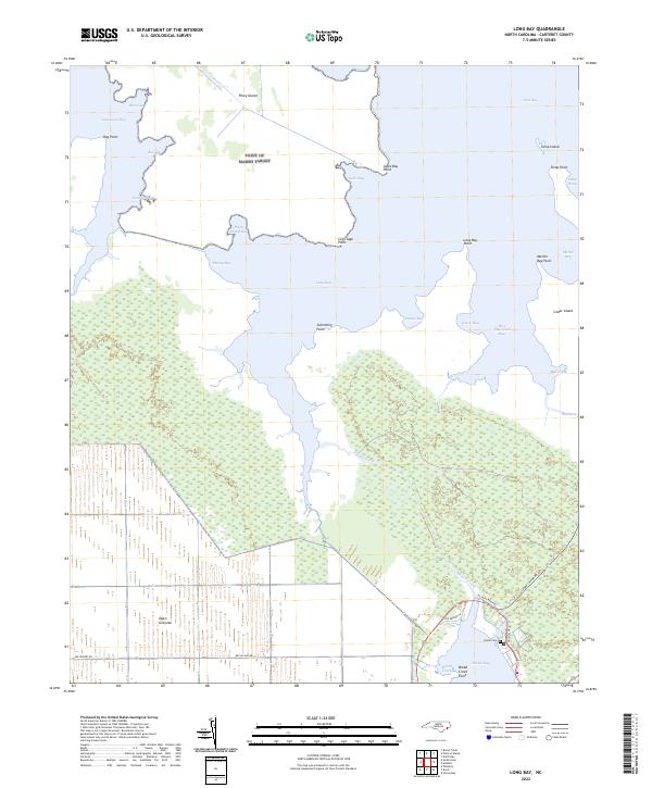
2022 Map of Long Bay
USGS Topo · Published 2022About this map
The labyrinthine wetlands and tidal guts of eastern Carteret County dominate this coastal landscape. Significant portions of the interior are defined by the Open Grounds, where a network of drainage canals and straight roads like Nelson Bay Rd meet the jagged shoreline of the Thorofare. The map details an environment where land and water are inextricably linked, featuring numerous small inlets such as Sanborns Gut and Deep Gut that feed into larger bodies like West Bay.
Find a feature on this map
38 named features on this map. Tap any name to fly to it.
Don’t see what you’re looking for? This feature index may not catch every label — zoom into the map to look around manually.
Map Details
Editions of this 2022 Long Bay Map
This is the sole edition of this map. No revisions or reprints were ever made.
Other maps of this area

1948 · North Bay
USGS Topo · 1:24,000

1949 · Atlantic
USGS Topo · 1:24,000

1949 · Styron Bay
USGS Topo · 1:24,000

1949 · Point Of Marsh
USGS Topo · 1:24,000

1949 · Long Bay
USGS Topo · 1:24,000

1949 · Williston
USGS Topo · 1:24,000

1949 · South River
USGS Topo · 1:24,000

1949 · Davis
USGS Topo · 1:24,000

1950 · Long Bay
USGS Topo · 1:24,000

1950 · South River
USGS Topo · 1:24,000