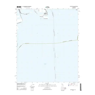
2015 Map of Long Beach OE S
USGS Topo · Published 2015About this map
Long Beach waterfront infrastructure and the vast maritime landscape of San Pedro Bay define this coastal study. The map documents the heavy industrial and logistical footprint of Terminal Island, where a network of piers and service roads like Navy Way and Nimitz Rd support one of the nation's busiest port complexes. The geography transitions from these engineered harbor facilities toward the recreational and residential shoreline of the Alamitos Peninsula in the east. Beyond the harbor breakwaters, the expanse of the Pacific Ocean is marked by the nautical routes of the Avalon-Long Beach Fry and related ferry lines, which connect the mainland to offshore destinations. This digital-era survey highlights the late-twentieth-century expansion of the harbor through large-scale land reclamation projects, notably seen in the configuration of Pier J Ave and the surrounding terminal expansions.
Find a feature on this map
17 named features on this map. Tap any name to fly to it.
Don’t see what you’re looking for? This feature index may not catch every label — zoom into the map to look around manually.
Map Details
Editions of this 2015 Long Beach OE S Map
This is the sole edition of this map. No revisions or reprints were ever made.
Other maps of this area

1896 · Redondo
USGS Topo · 1:62,500

1896 · Las Bolsas
USGS Topo · 1:62,500

1896 · San Pedro
USGS Topo · 1:62,500

1896 · Downey
USGS Topo · 1:62,500

1899 · Downey
USGS Topo · 1:62,500

1901 · Southern California Sheet No. 1
USGS Topo · 1:250,000

1902 · Downey
USGS Topo · 1:62,500

1904 · Southern California Sheet No. 1
USGS Topo · 1:250,000

1923 · Wilmington
USGS Topo · 1:24,000
1925 · Long Beach
USGS Topo · 1:24,000