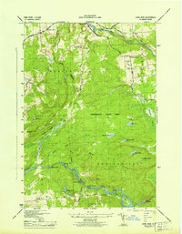
1943 Map of Long Bow
USGS Topo · Published 1943About this map
Parishville and Pickettville anchor the northern landscape of this St. Lawrence County study, where the foothills of the Adirondack State Park meet a complex network of river systems. The northern portion is defined by the West Branch St Regis River and its dramatic Sylvan Falls, while the southern reaches follow the winding course of the Raquette River. This area is characterized by a series of power-generating or timber-driving obstacles, including Rainbow Falls, Gain Twist Falls, Five Falls, and Little Falls.
Find a feature on this map
47 named features on this map. Tap any name to fly to it.
Don’t see what you’re looking for? This feature index may not catch every label — zoom into the map to look around manually.
Map Details
Editions of this 1943 Long Bow Map
This is the sole edition of this map. No revisions or reprints were ever made.
Other maps of this area

1908 · Potsdam
USGS Topo · 1:62,500

1919 · Nicholville
USGS Topo · 1:62,500

1920 · Childwold
USGS Topo · 1:62,500

1921 · Childwold
USGS Topo · 1:48,000

1921 · Nicholville
USGS Topo · 1:62,500

1921 · Stark
USGS Topo · 1:62,500

1922 · Childwold
USGS Topo · 1:62,500

1923 · Stark
USGS Topo · 1:62,500

1940 · Stark
USGS Topo · 1:62,500

1942 · Long Bow
USGS Topo · 1:24,000