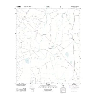
2011 Map of Long Branch
USGS Topo · Published 2011About this map
Seven Pines Cemetery and the northern reaches of the Salkehatchie River anchor this rural landscape in Barnwell County. The terrain is defined by a series of significant impoundments and small drainage systems, including Craigs Pond, Bolen Pond, and the Rosemary Creek watershed. These water features are often associated with local infrastructure, as seen with the Bolens Fishing Lake D-3063 Dam and Andersons Pond D-3059 Dam.
Find a feature on this map
64 named features on this map. Tap any name to fly to it.
Don’t see what you’re looking for? This feature index may not catch every label — zoom into the map to look around manually.
Map Details
Editions of this 2011 Long Branch Map
This is the sole edition of this map. No revisions or reprints were ever made.
Other maps of this area

1919 · Allendale
USGS Topo · 1:62,500

1920 · Ellenton
USGS Topo · 1:48,000

1920 · Talatha
USGS Topo · 1:48,000

1921 · Talatha
USGS Topo · 1:62,500

1921 · Ellenton
USGS Topo · 1:62,500

1923 · Williston
USGS Topo · 1:48,000

1927 · Williston
USGS Topo · 1:62,500

1943 · Allendale
USGS Topo · 1:62,500

1943 · Augusta East
USGS Topo · 1:125,000

1943 · Williston
USGS Topo · 1:62,500