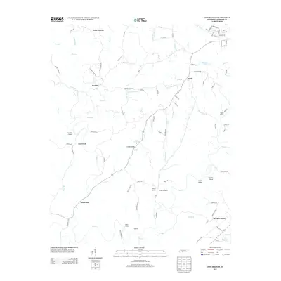
2013 Map of Long Branch
USGS Topo · Published 2013About this map
Mount Lebanon and Mount Zion anchor the northern and southern reaches of this Lawrence County landscape, where the terrain is defined by a dense network of creek valleys and hollows. The rural settlement pattern is tightly linked to the local hydrology, with communities like Spring Creek and Crewstown situated near vital water sources such as Bailey Spring and Durham Spring. In the southeast, Springers Station and the nearby Shack Lake indicate a transition toward more established transport corridors and infrastructure.
Find a feature on this map
108 named features on this map. Tap any name to fly to it.
Don’t see what you’re looking for? This feature index may not catch every label — zoom into the map to look around manually.
Map Details
Editions of this 2013 Long Branch Map
This is the sole edition of this map. No revisions or reprints were ever made.
Other maps of this area

1905 · Waynesboro
USGS Topo · 1:125,000

1936 · Westpoint
USGS Topo · 1:24,000

1936 · Deerfield
USGS Topo · 1:24,000

1936 · Lawrenceburg
USGS Topo · 1:24,000

1936 · Ethridge
USGS Topo · 1:24,000

1936 · Long Branch
USGS Topo · 1:24,000

1936 · Loretto
USGS Topo · 1:24,000
1936 · St. Joseph
USGS Topo · 1:24,000

1936 · Bonnertown
USGS Topo · 1:24,000

1936 · Ovilla
USGS Topo · 1:24,000