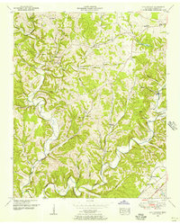
1951 Map of Long Branch
USGS Topo · Published 1956About this map
The Christian Home Orphanage sits at the northern edge of this rural landscape, marking a prominent social landmark in Lawrence County during the mid-twentieth century. The terrain is defined by the winding course of Shoal Creek and its many tributaries, such as Knob Creek and Long Branch, which carve numerous hollows into the upland, including Limekiln Hollow and Drake Hollow. Transport and commerce are concentrated in the south, where the Louisville and Nashville railroad passes through Springers Station alongside the Nashville and Northwestern Highway.
Find a feature on this map
64 named features on this map. Tap any name to fly to it.
Don’t see what you’re looking for? This feature index may not catch every label — zoom into the map to look around manually.
Map Details
Editions of this 1951 Long Branch Map
2 editions found
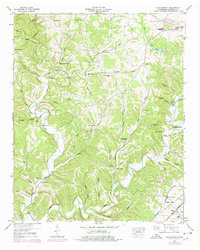
Other maps of this area

1905 · Waynesboro
USGS Topo · 1:125,000

1936 · Westpoint
USGS Topo · 1:24,000

1936 · Deerfield
USGS Topo · 1:24,000

1936 · Lawrenceburg
USGS Topo · 1:24,000

1936 · Ethridge
USGS Topo · 1:24,000

1936 · Long Branch
USGS Topo · 1:24,000

1936 · Loretto
USGS Topo · 1:24,000
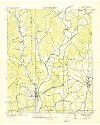
1936 · St. Joseph
USGS Topo · 1:24,000

1936 · Bonnertown
USGS Topo · 1:24,000

1936 · Ovilla
USGS Topo · 1:24,000