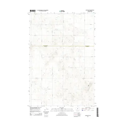
2014 Map of Long Butte
USGS Topo · Published 2014About this map
Long Butte rises as a prominent landmark in this prairie landscape along the southern border of Hettinger County. The map documents a section of the High Plains where the drainage of Timber Cr carves across the northern townships, creating subtle relief against the structured grid of the Public Land Survey System. The area is defined by its agricultural layout, marked by a precise network of section-line roads such as 14th Ave NE and 93rd Ave SW. A small cultural center exists near the base of the butte, where the Long Butte Cem provides a specific point of interest for genealogists tracing families from this rural corner of North Dakota. The boundary between Hettinger County and Adams County bisects the sheet, illustrating how political lines often follow the straight-edge geometry of the Western plains regardless of local topography.
Find a feature on this map
26 named features on this map. Tap any name to fly to it.
Don’t see what you’re looking for? This feature index may not catch every label — zoom into the map to look around manually.
Map Details
Editions of this 2014 Long Butte Map
This is the sole edition of this map. No revisions or reprints were ever made.
Other maps of this area

1953 · Dickinson
USGS Topo · 1:250,000

1957 · Dickinson
USGS Topo · 1:250,000

1966 · Mott South
USGS Topo · 1:24,000

1966 · Mott SW
USGS Topo · 1:24,000

1969 · Burt
USGS Topo · 1:24,000

1974 · Pearl Butte NW
USGS Topo · 1:24,000

1974 · Cedar Butte
USGS Topo · 1:24,000

1974 · Long Butte
USGS Topo · 1:24,000

1980 · Mott
USGS Topo · 1:100,000
2011 · Barths Butte
USGS Topo · 1:24,000