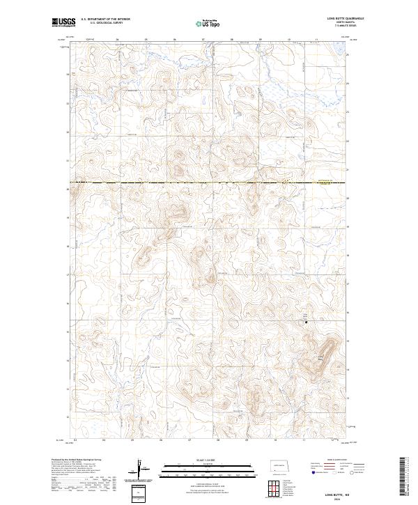
2024 Map of Long Butte
USGS Topo · Published 2024About this map
The prominent elevation of Long Butte anchor this section of the Great Plains on the border of North Dakota's Hettinger and Adams counties. The landscape is characterized by a sparse, grid-based network of section roads like 95th Ave SW and 81st St SW, which reflect the late-stage development of this agricultural region. The Long Butte Cem remains a significant local landmark, situated just north of the butte itself, serving as a primary point of interest for genealogists tracing family ties to the surrounding homesteads. In the northern reaches of the quadrangle, the seasonal flow of Timber Creek meanders through the plains, providing a rare natural break in the strictly rectangular township and range system that otherwise defines the property boundaries and road placements of this rural landscape.
Find a feature on this map
28 named features on this map. Tap any name to fly to it.
Don’t see what you’re looking for? This feature index may not catch every label — zoom into the map to look around manually.
Map Details
Editions of this 2024 Long Butte Map
This is the sole edition of this map. No revisions or reprints were ever made.
Other maps of this area

1953 · Dickinson
USGS Topo · 1:250,000

1957 · Dickinson
USGS Topo · 1:250,000

1966 · Mott South
USGS Topo · 1:24,000

1966 · Mott SW
USGS Topo · 1:24,000

1969 · Burt
USGS Topo · 1:24,000

1974 · Pearl Butte NW
USGS Topo · 1:24,000

1974 · Cedar Butte
USGS Topo · 1:24,000

1974 · Long Butte
USGS Topo · 1:24,000

1980 · Mott
USGS Topo · 1:100,000
2011 · Barths Butte
USGS Topo · 1:24,000