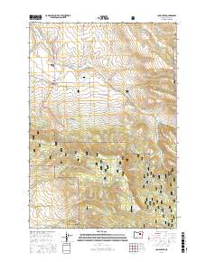
2017 Map of Long Creek
USGS Topo · Published 2017About this map
Long Creek sits at the heart of this high-plateau landscape, serving as a hub for the local ranching and forest-based economy within Malheur National Forest. The settlement is defined by its strategic location along CO Hwy 18 and CO Hwy 14, with the Long Creek Cem and a central Po marking its communal core. The surrounding terrain is a complex network of drainages and canyons, including Dale Canyon and War Canyon, which feed into the primary waterways of S Fork Long Cr and Alder Brook. A significant portion of the landscape is dedicated to the Long Creek Municipal Watershed, highlighting the critical importance of water management in this high-elevation environment. Numerous named springs and brooks, such as Willow Spring and Bingville Cr, trace the contours of Long Creek Mtn, illustrating the intricate natural hydrology that sustains the region's forest land.
Find a feature on this map
46 named features on this map. Tap any name to fly to it.
Don’t see what you’re looking for? This feature index may not catch every label — zoom into the map to look around manually.
Map Details
Editions of this 2017 Long Creek Map
This is the sole edition of this map. No revisions or reprints were ever made.
Other maps of this area

1949 · Long Creek
USGS Topo · 1:62,500

1949 · Susanville
USGS Topo · 1:62,500

1950 · Ritter
USGS Topo · 1:62,500

1951 · Susanville
USGS Topo · 1:62,500

1951 · Long Creek
USGS Topo · 1:62,500

1951 · Dale
USGS Topo · 1:62,500

1952 · Ritter
USGS Topo · 1:62,500

1955 · Canyon City
USGS Topo · 1:250,000

1959 · Canyon City
USGS Topo · 1:250,000

1980 · Monument
USGS Topo · 1:100,000