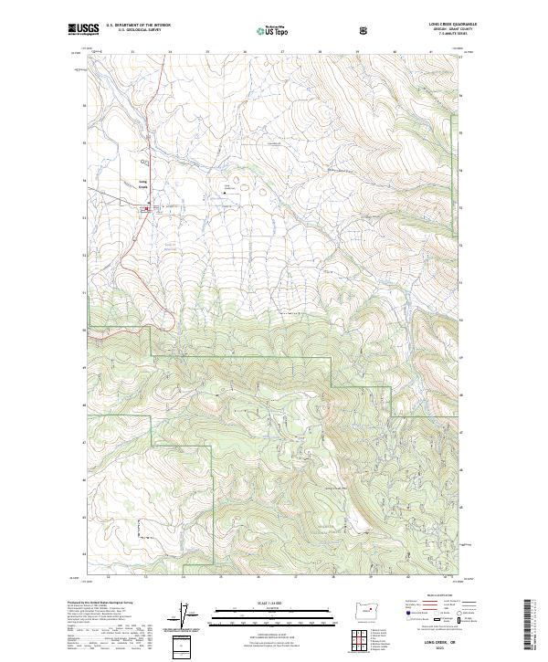
2023 Map of Long Creek
USGS Topo · Published 2023About this map
The settlement of Long Creek sits at the junction of Co Hwy 18 and Highway 395, serving as a gateway to the high-country drainages of central Grant County. The landscape is defined by the steep transition from the creek valley floor up toward the prominent Long Creek Mtn, which dominates the southern half of the quadrangle. This 2023 survey illustrates a landscape of managed timberlands and riparian corridors, where the northern boundaries of the Malheur National Forest meet private ranchlands and small-scale water management projects like the Long Cr Reservoir. Numerous named tributaries, including Alder Brook, Bingeville Creek, and Smith Creek, carve through the complex topography of War Canyon and Harer Canyon. For local historians and genealogists, the Long Creek Cem and the central Po remain key landmarks within the small township footprint.
Find a feature on this map
39 named features on this map. Tap any name to fly to it.
Don’t see what you’re looking for? This feature index may not catch every label — zoom into the map to look around manually.
Map Details
Editions of this 2023 Long Creek Map
This is the sole edition of this map. No revisions or reprints were ever made.
Other maps of this area

1949 · Long Creek
USGS Topo · 1:62,500

1949 · Susanville
USGS Topo · 1:62,500

1950 · Ritter
USGS Topo · 1:62,500

1951 · Susanville
USGS Topo · 1:62,500

1951 · Long Creek
USGS Topo · 1:62,500

1951 · Dale
USGS Topo · 1:62,500

1952 · Ritter
USGS Topo · 1:62,500

1955 · Canyon City
USGS Topo · 1:250,000

1959 · Canyon City
USGS Topo · 1:250,000

1980 · Monument
USGS Topo · 1:100,000