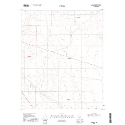
2023 Map of Long Draw
USGS Topo · Published 2023About this map
Arid drainage patterns and township boundaries define this corner of Guadalupe County, dominated by the watercourse known as Long Draw. The landscape reflects a traditional Western survey grid, segmented into ranges T5N, T4N, and T3N, which organize the sparse ranching and travel infrastructure of the high plains. Local transit is limited to a few named thoroughfares, including Perez Rd, Eden Rd, and Rica Rd, which traverse the open terrain toward the depression of Sotano Blanco. This 2023 survey by the U.S. Geological Survey illustrates how the physical geography of the high desert dictates the placement of rural roads and the management of public and private lands in this section of New Mexico.
Find a feature on this map
11 named features on this map. Tap any name to fly to it.
Don’t see what you’re looking for? This feature index may not catch every label — zoom into the map to look around manually.
Map Details
Editions of this 2023 Long Draw Map
This is the sole edition of this map. No revisions or reprints were ever made.
Other maps of this area

1954 · Fort Sumner
USGS Topo · 1:250,000

1958 · Fort Sumner
USGS Topo · 1:250,000

1978 · Mesa Leon
USGS Topo · 1:24,000

1978 · Vaughn
USGS Topo · 1:24,000

1978 · El Morro Ranch
USGS Topo · 1:24,000

1978 · El Morro Ranch NW
USGS Topo · 1:24,000

1978 · Long Draw
USGS Topo · 1:24,000
1978 · Burro Lake
USGS Topo · 1:24,000

1979 · Fort Sumner
USGS Topo · 1:100,000

1980 · Corona
USGS Topo · 1:100,000