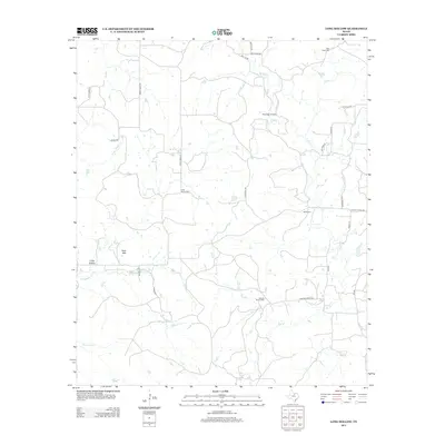
2012 Map of Long Hollow
USGS Topo · Published 2012About this map
Long Hollow and the surrounding Palo Pinto County ranchlands are defined by a network of seasonal watercourses and scattered family burial grounds. This 2012 survey reveals a landscape where modern infrastructure like Flamingo Airfield exists alongside deep-rooted rural sites such as Long Hollow Cem and Halsell Ranch Cem. The drainage patterns of Salt Creek and Dillingham Cr dictate the layout of the local road system, which includes named thoroughfares like Barton Chapel Rd and Marsell Ranch Rd. High points such as Deck Mtn overlook the winding paths of Pinnington Cr and Dry Br, illustrating the varied topography of north-central Texas. This record is particularly valuable for documenting family-named landmarks and rural cemeteries that may be difficult to locate in more developed areas.
Find a feature on this map
31 named features on this map. Tap any name to fly to it.
Don’t see what you’re looking for? This feature index may not catch every label — zoom into the map to look around manually.
Map Details
Editions of this 2012 Long Hollow Map
This is the sole edition of this map. No revisions or reprints were ever made.
Other maps of this area

1891 · Palo Pinto
USGS Topo · 1:125,000

1918 · Palo Pinto
USGS Topo · 1:125,000

1924 · Palo Pinto 2-b
USGS Topo · 1:48,000

1924 · Palo Pinto 2-a
USGS Topo · 1:48,000

1924 · Palo Pinto 1-b
USGS Topo · 1:48,000

1927 · Pickwick
USGS Topo · 1:62,500

1927 · Mineral Wells
USGS Topo · 1:62,500

1954 · Abilene
USGS Topo · 1:250,000

1954 · Wichita Falls
USGS Topo · 1:250,000

1958 · Wichita Falls
USGS Topo · 1:250,000