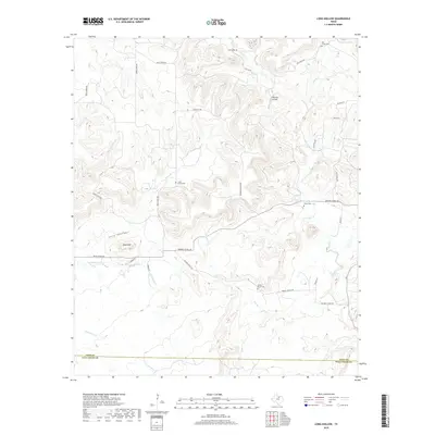
2019 Map of Long Hollow
USGS Topo · Published 2019About this map
Deck Mountain and the winding drainage of Long Hollow anchor this landscape along the border of Jack and Palo Pinto Counties. The map reveals a rural network of family-named ranching and cemetery sites, including Halsell Ranch Cemetery and Wood Cemetery, illustrating the lineage of local settlement across the North Texas prairies. Transportation patterns are defined by cattle-country thoroughfares like Barton Chapel Road and Rock Creek Road, which navigate the elevation changes between the upland ridges and the creek beds of Salt Creek and Pinnington Creek. A notable modern landmark, Flamingo Airfield, sits in the northern portion of the quadrangle, highlighting the continued utility of this open terrain for regional aviation amidst traditional land use.
Find a feature on this map
29 named features on this map. Tap any name to fly to it.
Don’t see what you’re looking for? This feature index may not catch every label — zoom into the map to look around manually.
Map Details
Editions of this 2019 Long Hollow Map
This is the sole edition of this map. No revisions or reprints were ever made.
Other maps of this area

1891 · Palo Pinto
USGS Topo · 1:125,000

1918 · Palo Pinto
USGS Topo · 1:125,000

1924 · Palo Pinto 2-b
USGS Topo · 1:48,000

1924 · Palo Pinto 2-a
USGS Topo · 1:48,000

1924 · Palo Pinto 1-b
USGS Topo · 1:48,000

1927 · Pickwick
USGS Topo · 1:62,500

1927 · Mineral Wells
USGS Topo · 1:62,500

1954 · Abilene
USGS Topo · 1:250,000

1954 · Wichita Falls
USGS Topo · 1:250,000

1958 · Wichita Falls
USGS Topo · 1:250,000