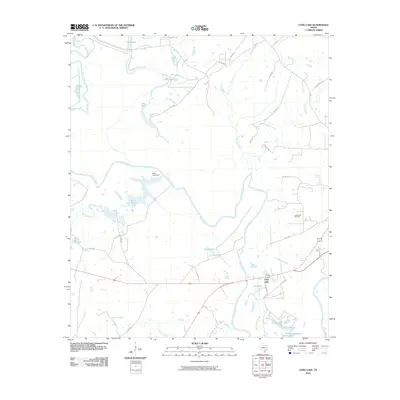
2010 Map of Long Lake
USGS Topo · Published 2010About this map
The Trinity River snakes through this Anderson County landscape, carving a complex network of oxbow lakes and wetlands that define the local geography. The settlement of Long Lake serves as a central point near the southern bend of the river, surrounded by a hydrologic system including Mud Lake, Smith Lake, and the expansive Salt Water Slough. This environment is shaped by both natural watercourses like Keechie Creek and human intervention, most notably the Blue Lake Dam which regulates the waters of Blue Lake.
Find a feature on this map
40 named features on this map. Tap any name to fly to it.
Don’t see what you’re looking for? This feature index may not catch every label — zoom into the map to look around manually.
Map Details
Editions of this 2010 Long Lake Map
This is the sole edition of this map. No revisions or reprints were ever made.
Other maps of this area

1949 · Palestine
USGS Topo · 1:62,500

1949 · Tennessee Colony
USGS Topo · 1:62,500

1950 · Palestine
USGS Topo · 1:62,500

1950 · Tennessee Colony
USGS Topo · 1:62,500

1951 · Elkhart
USGS Topo · 1:62,500

1953 · Palestine
USGS Topo · 1:250,000

1957 · Palestine
USGS Topo · 1:250,000

1964 · Long Lake
USGS Topo · 1:24,000

1964 · Oakwood
USGS Topo · 1:24,000

1964 · Keechi
USGS Topo · 1:24,000